Source:
ChatGPT:
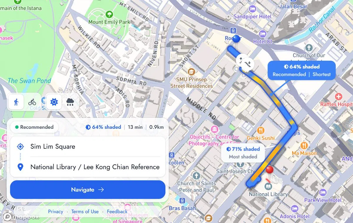
The application analyses Singapore's network of more than 200km of sheltered walkways while also considering natural shade from buildings. Using building footprint and height information from OpenStreetMap, it estimates how shadows change depending on the time of day and month, allowing it to recommend routes with greater shade. It also includes lesser-known shortcuts through HDB estates and back alleys that traditional navigation apps may overlook.
Users are presented with three route options: the shortest route, the most shaded or sheltered route, and a recommended route that balances walking distance with weather protection. A colour gradient highlights hotter and cooler sections, while separate "shaded" and "sheltered" modes distinguish between natural shade and roof-covered walkways for rainy weather. Cycling routes are also available.
However, the app has several limitations. It currently focuses only on walking and short distances, with no end-to-end public transport journey planning. Users travelling by bus or MRT must search for separate walking segments. The developers plan to improve the platform by adding tree canopy data, better accessibility information and enhanced navigation features. They are also encouraging the public to test the beta version and provide feedback before wider deployment.
Social media and forum discussions
HardwareZone
The article generated strong interest on HardwareZone, where members praised the idea as a practical solution for Singapore's tropical climate. Popular discussion points include:
Appreciation for using OpenStreetMap and open data.
Comparisons with Google Maps, which optimises for speed rather than comfort.
Requests for integration with bus and MRT navigation.
Suggestions to include real-time weather, construction works and tree canopy data.
Overall sentiment: Very positive, with many users saying they would use the app daily.
On Singapore-focused subreddits such as r/singapore and r/asksingapore, users discussed:
How sheltered walkways are one of Singapore's unique urban planning features.
Whether the app could become integrated into mainstream navigation apps.
Praise for the hackathon team creating something with immediate public value.
Suggestions for wheelchair accessibility, barrier-free routes and covered pedestrian bridges.
Many commenters also joked that avoiding the midday sun is "peak Singaporean behaviour."
X (formerly Twitter)
Posts mainly shared the news article and demo screenshots. Users described the app as:
"Actually useful."
"One of the better hackathon ideas."
A welcome solution during Singapore's increasingly hot weather.
Technology pages and community groups shared the article, with comments focusing on:
Elderly family members benefiting from cooler walking routes.
Parents using it when walking with young children.
Calls for an official government-supported version.
Tech creators and local news accounts highlighted the app's interface and colour-coded heat map. Engagement centred on how it could make walking more comfortable during Singapore's hot afternoons.
TikTok
Short demo videos showing route comparisons attracted positive reactions. Users appreciated seeing alternative shaded paths that they had never noticed before.
Threads
Discussion echoed Instagram, with users praising the concept while suggesting future features such as:
Live rain radar integration.
Tree shade coverage.
Indoor mall connections.
Support for entire bus/MRT journeys.
Overall public sentiment
Public reception is overwhelmingly positive. The consensus is that Undercover addresses a genuine everyday problem for Singapore residents by prioritising comfort over speed. While users recognise that the beta version has limitations—particularly around public transport integration and route coverage—they view it as an innovative civic technology project with significant potential. The most requested enhancements include live weather integration, accessibility improvements, comprehensive transport planning, and more accurate shade data using tree canopy information. If these features are added, many believe Undercover could become an indispensable navigation tool for pedestrians in Singapore.
No comments:
Post a Comment